Builders and Defenders
Spatial Historian
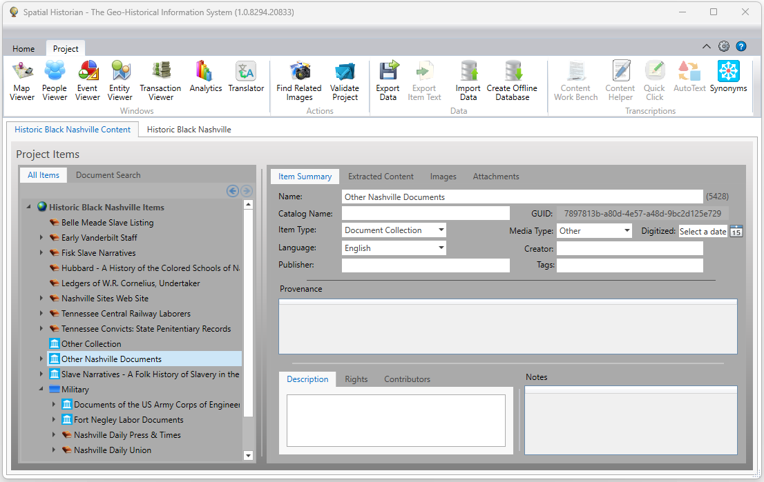
Much of the work being done by historians and geneologist aims to understand the People, Places, and Events that appear in our records. Robust information management is required to not only record these individual components but allow them to be tightly linked within the underlying data structures and visually navigable from within the user interface. To this end, an integrated customized system has been developed, called the Spatial Historian, capable of assisting historians in the collaborative real-time capture and management of structured and unstructured data contained in archival sources that facilitates subsequent data mining and geo-historical information exploration. The essential components of the system allow researchers to manage libraries of source material, enter and normalize transcriptions, extract content, establish links between people, places, and events, and make the results available to the public.
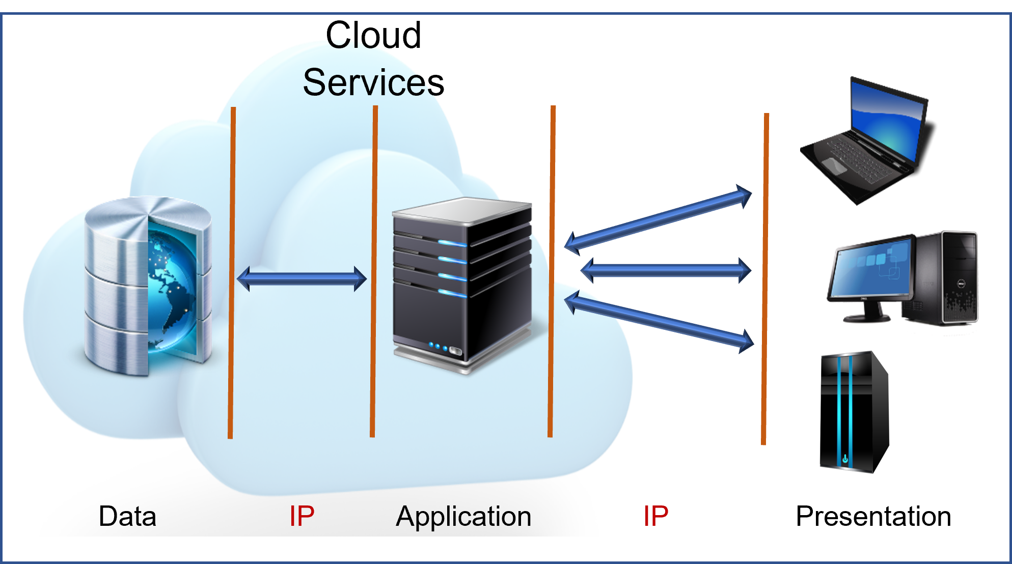
The Spatial Historian implements a multi-tier architecture which is composed of three layers of logical processing and is comprised of a data tier, an application tier, and a presentation tier. This architecture provides many benefits for the production and development environments by compartmentalizing the user interface, business logic, and data storage functionality. Doing so allows specific parts of the system to be updated independent of the other parts and this reduces development cycle times by offering the ability to replace or upgrade independent tiers without affecting the remainder of the system. For example, user interfaces and web sites can be developed based on user feedback without affecting the underlying functional business and data access logic.
This architecture also allows access to the data from anywhere with internet access, facilitating collaborative research across the globe.
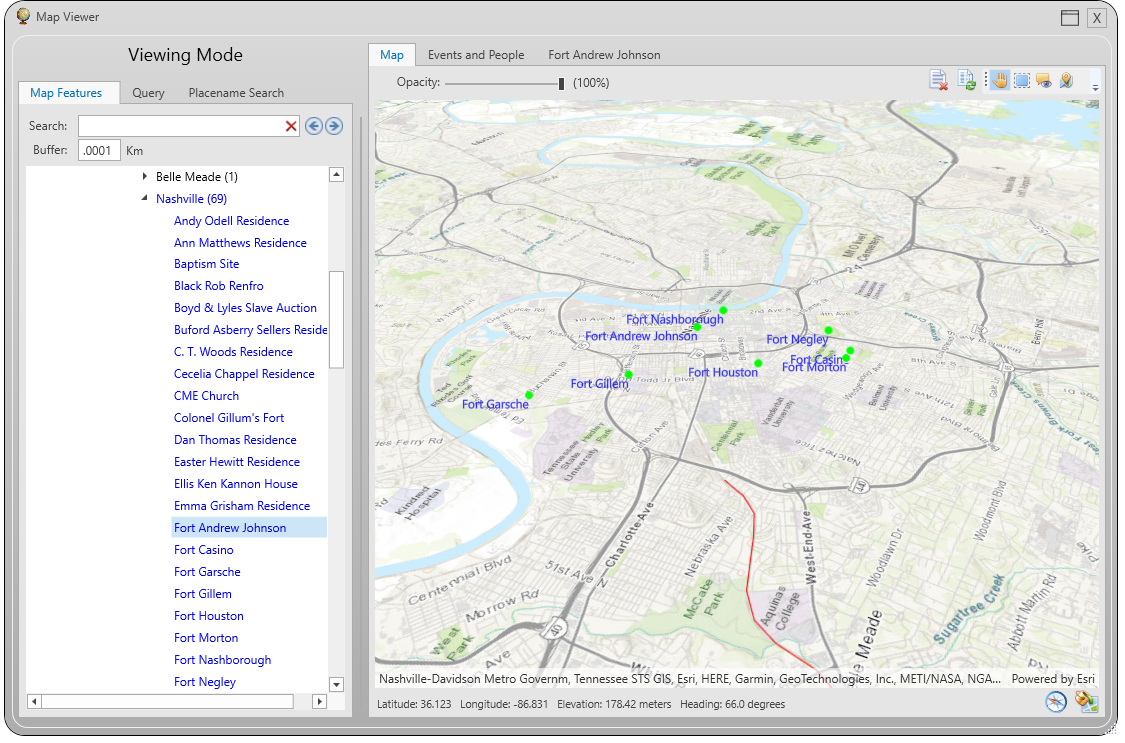
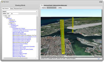
While it may sound trite, all history happens somewhere. Geography, topography, and proximity can can be significant factors affecting how events unfold. To aid in understanding the spatial context in which historical events occur the Spatial Historian system allows researchers to connect locations to historical events and to the life events of individuals. In addition, the locations of historical materials can be traced over time along as they may move from the places where they were created to the archives and libraries where they currently reside. Also, the locations of historical places such as schools, railroads, and forts can be mapped, so that when we talk about, for instance, work occuring at Civil War forts that we built in Nashville, the locations can be viewed on a map to help develop a sense for the strategy behind their placement and the travel distances involved for those who worked on them. .
The life events of individuals are often influenced by external events. External factors could be naturally occurring events such as a volcano or earthquake, or human mediated events such as the inadvertent transport of a plague, or the voyage of a slave ship. These external events can be characterized in several ways. The first is that these types of events affect a significant number of people who may otherwise have no common connection, acting as a links between individuals and communities and creating shared experiences. A second characteristic is that these types of events have a definable temporal extent in that they have a start time and an end time. The duration may be very short, as in the case of an earthquake, or may last for months as in the case of a plague with the impact of the event varying throughout its existence. A third characteristic is that these events and their resulting effects have a definable spatial extent. This is the area within which individuals are impacted or influenced in a common way though the actual impact on individuals may vary widely based on factors such as social status, wealth, access to resources.
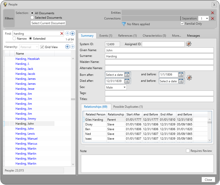
Of course, history is all about people; things that people do and things that are done to them. It is about actions, relationships, connections to places, and connections to society. And, it is about characteristics, such as skin color and sex, and how those characteristics are used to define the roles expected of individuals within society. Historical records are replete with these types of details, in some cases to the point where the volume of details can become difficult to manage using standard methods such as spreadsheets or word processing documents. In addition, the details that are recorded can be difficult to analyze and significant connections can become lost in the forest of information. Spatial Historian provides the ability for researchers to enter details about individuals such as sex, relationships, birth and death dates, life events, source materials where they are referenced, occupations, and connections to entities such as schools, churches, or military units. The real benefit is that, without any specialized technical training, users can filter lists of people by any of these attributes, can easily view personal and social connections, and can create statictical output in the form of charts, maps, and spreadsheets (including pivot tables).